Resilience Assessments: the Körösök Völgye case
Due to climate change, water flow in the Körös rivers is steadily declining following the decrease of rainfall and the increase of water-usage in Romania. Estimations set the timeframe for adaptation to be between 10 and 20 years.
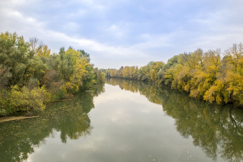
The Körösök Völgye Naturpark is, roughly, an 80-kilometre-wide area along the three Körös rivers — located between the Eastern border of Hungary and the Tisza River. Essentially, the Naturpark is an NGO founded by municipalities and local associations from the area with the mission of supporting rural development, eco-tourism, and ecological awareness-raising.
In this line, Naturepark invited CEEweb to conduct its second Pilot Resilience Assessment via a workshop in Békéscsaba. The first step of the workshop dealt with understanding the purpose of the methodology and the local context. This was the first time where our project objective — to test and refine our methodology multiple times — showed its advantage: the same structure that had been previously used on our online assessment process in the Homokhátság region was not usable in this case. The main difference was the lack of clear focus — since Körösök Völgye is in a much better ecological condition compared to Homokhátság. Thus, local stakeholders do not have a problem related to awareness.
It was decided to skip some of the steps from the workbook’s get-go and focus instead on carrying out a “historical timeline” exercise following the methodology of the Wayfinder Resilience Assessment workbook. Participants decided to consider 300 years in the timeline exercise as many changes that started in the 1700s are still defining features of the landscape. Ultimately, in an engaging and interesting process that was hard to stop, constructing the full timeline took around seven hours. Doing so not only provided information on the historical development of the social-ecological system but facilitated the co-creation of a systemic view of the landscape, implicitly helping decide many questions that were left out from the original scoping exercises and offering a smooth transition to scenario planning.

With the timeline defined, the exercise to develop a pathway to a resilient future became shorter and less demanding. We started with a long-term, transformative vision that would change the landscape in a significant way: develop a new water-management system that resembles the historical character of the landscape — before the floodplains were drained. The participants were successful in finding a step-by-step participatory approach to get there, starting small, building alliances, measuring impact, doing research, and demonstrating the benefits of their approach.
The workshops resulted in a clear vision: a plan that is achievable in theory and that can be built into shorter-term projects. Of course, doing a workshop was the easy part; now, the implementation needs to be organized. The Körösök Völgye Naturpark is committed to doing so but it will require significant preparation, project planning, and dedication.
Needless to say, this kind of work is one that must be done. The outcome of the resilience assessment process was clear: due to climate change, water flow in the Körös rivers is steadily declining following the decrease of rainfall and the increase of water usage in Romania. Since agriculture in the Körös valley is dependent on irrigation and demand for irrigation water is also increasing due to climate change, the current system will lead to a disaster sooner or later. More studies would be needed to model possible futures, but the participating experts estimated the timeframe for adaptation between 10 and 20 years. After that, serious droughts are expected; the rivers might run out of water. Reconstructing the system from that situation would be much harder — if not impossible.